


Construction Visual Documentation: Drone, Photography and Time-Lapse
Drone, Ground Photography and Time-Lapse: What Each Reveals on a Construction Project
Construction visual documentation brings together drone imagery, ground photography and time-lapse to show different aspects of a project. Each format has its strengths. Choosing the right combination starts with understanding what you need to capture, who will use it and how it will support your project.
Time-lapse shows how a project changes
Long-term construction time-lapse captures images at planned intervals from a fixed position. Over time, those images show the project taking shape. Its strength is consistency. Viewers can follow change without constantly adjusting to a different angle. A sequence can show excavation progressing, a structure rising or a site moving towards completion.
Builders can also use the imagery during the project. From our experience, teams find value in reviewing visible site activity, preparing progress videos and explaining construction sequences.
The final construction visual documentation video serves another purpose. It condenses months or years of work into a visual story for clients, stakeholders and future project marketing.
Where fixed time-lapse has limits
A fixed camera only records what falls within its view. Scaffolding, cranes and new structures can obscure activity. Work inside a building may remain invisible from an external position. A wide view may show overall progress without revealing smaller details. Time-lapse therefore needs careful camera placement. It may also need supporting coverage from other viewpoints. A well-positioned camera can tell a powerful story. It cannot tell every part of it.
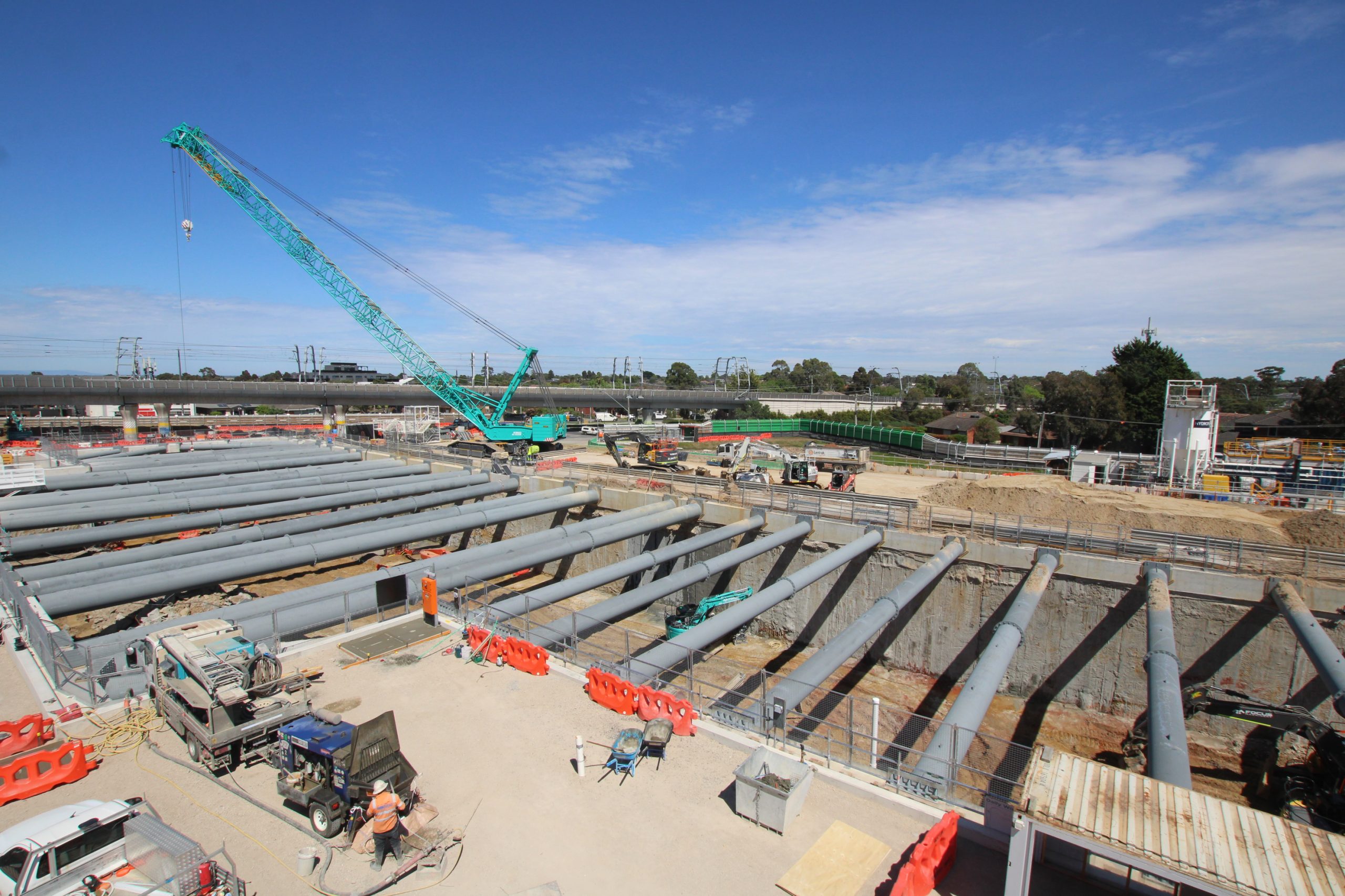
Time-lapse construction photography documenting steel bracing, excavation works and crane activity at Clayton.
Drone photography reveals scale and context
Drone photography can show how a project fits into its surroundings. It can help viewers understand the relationship between buildings, access roads, work zones and neighbouring areas. On a large site, that wider perspective can make the overall layout easier to follow.
Aerial images can also reveal areas that a fixed external camera cannot see clearly, such as roof-level activity or work on another side of a development. Repeatable viewpoints make progress comparisons more useful. Consistent framing helps viewers compare dates without mentally reorienting themselves each time.
Drone footage can also complement a final construction visual documentation film. It can establish the location, reveal the scale of the finished development and connect the time-lapse sequence with the completed result
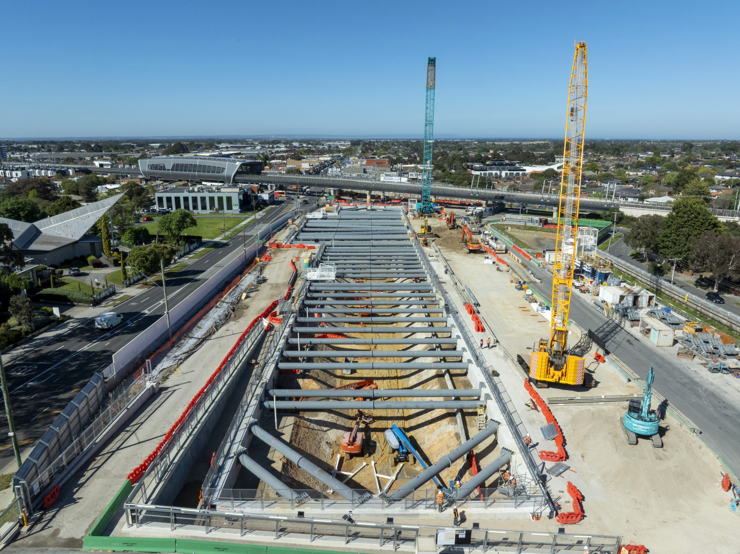
Drone photography documenting deep excavation works, extensive steel bracing and crane activity at Clayton.
Where drone coverage has limits
A drone visit captures selected moments. It does not record everything that happens between visits. A monthly flight may show substantial change, but it may miss the activity that produced it. Access to aerial viewpoints also depends on the operating conditions. Site permission alone does not determine whether a flight can proceed.
Operators must follow the rules that apply to their operation and protect aircraft, people and property. CASA also recommends checking a CASA-verified drone safety app before each flight. Plan drone coverage early so the operator can assess the location, site activity and any relevant requirements.
Ground photography captures the detail
Ground photography brings the viewer closer to the project. It can show materials, finishes, interiors and architectural features that appear too small in an aerial image or wide time-lapse view. It can also show the people behind the work, where site access, safety requirements and permissions allow.
For a builder or developer, this creates opportunities to explain what makes the project distinctive. A wide image may establish the building. A closer photograph can show the care in a façade junction, a finished interior or a particular material treatment.
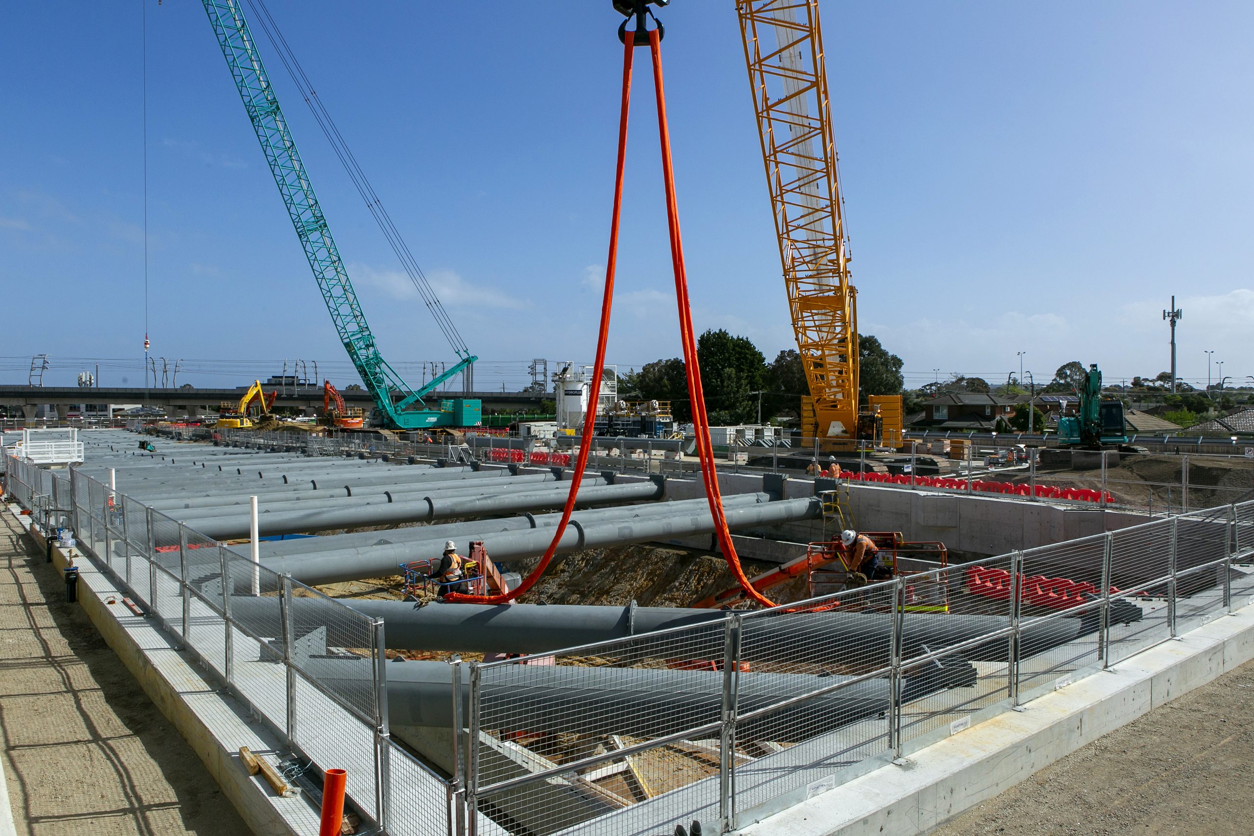
Construction photography capturing crane-assisted positioning of a steel strut within a large braced excavation at Clayton.
Where ground photography has limits
Ground-level views do not always explain the scale or layout of a large project. An individual image may show one area clearly while leaving its relationship to the rest of the site unclear. Scheduled visits also leave gaps between capture dates. They cannot replace an ongoing time-lapse record.
Ground photography contributes detail and deliberate composition. It works best when the wider project context is also clear. The value comes from matching each format to a communication need. A project does not become better documented simply because it has more footage. It needs the right views at the right stages.
Build the coverage around project milestones
A combined approach should follow the construction program. Start by identifying the stages that matter most. Then decide which perspective will explain each stage clearly.
For example, a project might use:
Pre-construction ground and aerial images to establish the original site.
A fixed time-lapse camera to record change throughout the build.
Drone visits to show major changes in layout, scale or structure.
Ground photography to document selected activities and details.
Completion photography to showcase finished spaces and materials.
Final aerial footage to place the completed project in context.
This is an example, not a standard package. Some projects need more frequent visits during a particular stage. Others benefit from coverage focused on a few major milestones.
The brief should reflect the construction sequence and intended use—not an arbitrary calendar.
Give every capture a purpose
Different audiences need different information. A site team may want a clear visual record of visible progress. A developer may need material for investor updates. A community-engagement team may need to explain how infrastructure works are advancing. A marketing team may want completed-project images for tenders, case studies and future campaigns.
Do all projects need all three?
No. A focused brief may justify only one or two formats. A small project may need professional completion photography rather than a long-term camera installation. A short, significant work sequence may benefit from targeted time-lapse rather than months of coverage. Major projects should, however, consider what any single format will miss.
If a fixed camera cannot see the far side of a structure, another perspective may be worthwhile. If aerial imagery explains the site but not its finished quality, ground photography can fill that gap. Choose the combination that answers the project’s questions. Do not add formats without a reason.
Plan the final story before construction starts
The strongest construction visual documentation record begins with a clear plan. Early involvement gives the team time to assess camera positions, arrange access, coordinate visits and identify significant milestones. It also helps align operational needs with future marketing and communications.
At Capture Point Media, our aim is to make these perspectives work together. Time-lapse shows the transformation. Drone imagery explains the scale and context. Ground photography reveals the detail and finished quality. Together, they can tell a fuller story than any one viewpoint alone.
Planning a construction, redevelopment or infrastructure project? Speak with Capture Point Media early to discuss the coverage that will support your project during construction and showcase it at completion.